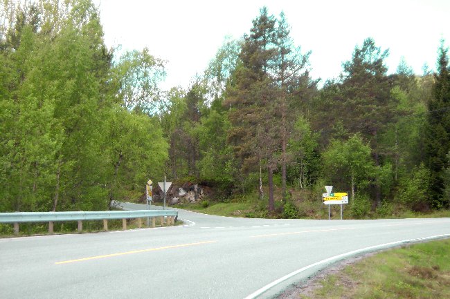
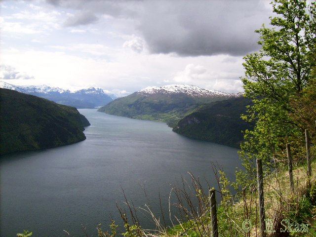
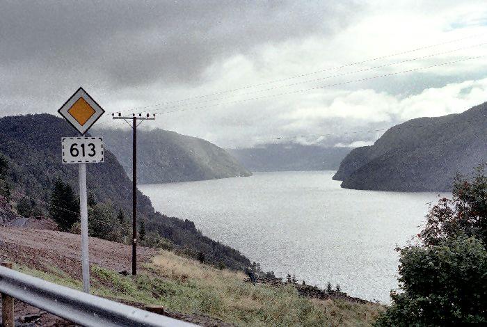
Route 613, also called the "Panorama Road" . .
.
. . winds off from route 15/60 about 7 Km
west of Stryn.
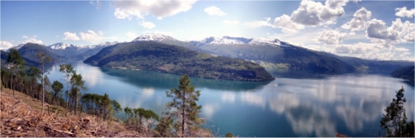
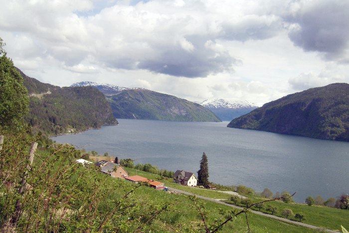
-along this road you will find living rural communities, Different kind of
activities to join, In addition of lovely nature with a "panorama view to
the fjord and the communities, the mountains and the glaciers at the south
side. Panoramas like
the one on top of this page, at Robjoergane, will be seen many places along
the road
This page will take you on a trip along this road
Click photos to enlarge.
The road made a crossing of Nordfjord at Innvik/Faleide, went up the hillside, trough the Markane district, trough Hornindal, along the deepest lake in Europe, and over to the Møre County.
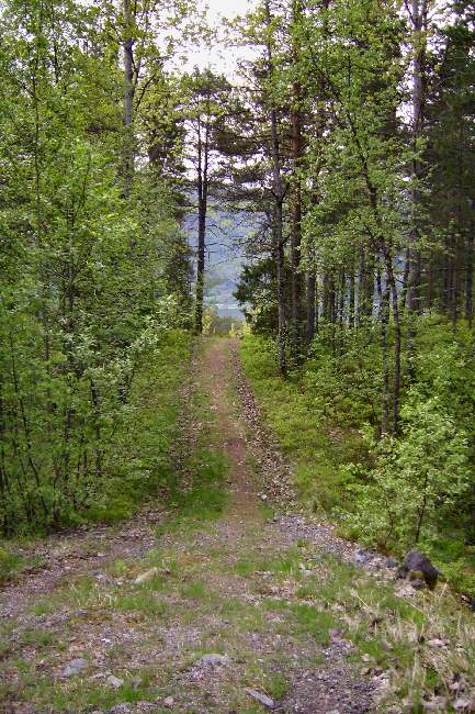
The road is partly restored, and
is easy to walk. Some people even do bicycle riding here.
Please
do not use motor bikes or similar equipments on this road!
Some Km further north, you can see bridges like this one in Markane
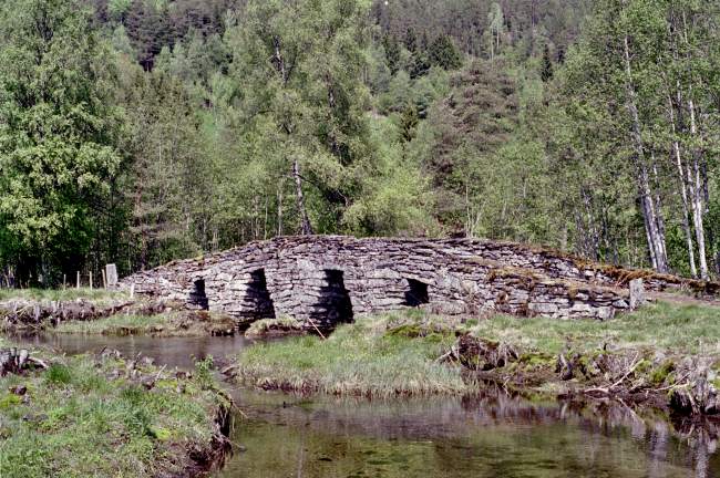
Dalehoegda, Robjoergane
Ulvedal is a small community with a rich amount of
attractions, cultural as well as historical.
This sign will lead you to some of the attractions nearby, and describes the
estimated time to get there by foot.
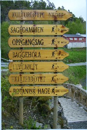
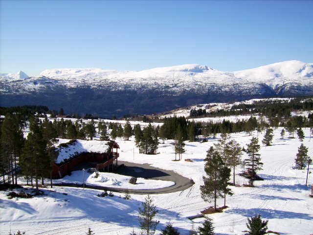
Outdoor
pursuits centre, Lovely touring ground, Ski centre,
.with
in the winter season prepared cross country tracks.
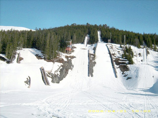
The jump hills from 5 to 90 m are sports facility for Sogn and
Fjordane County.
Arena for national and World Cups in Nordic ski competitions.
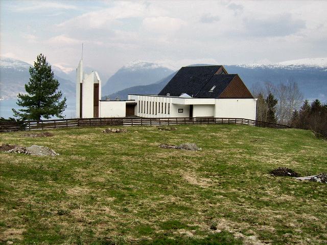
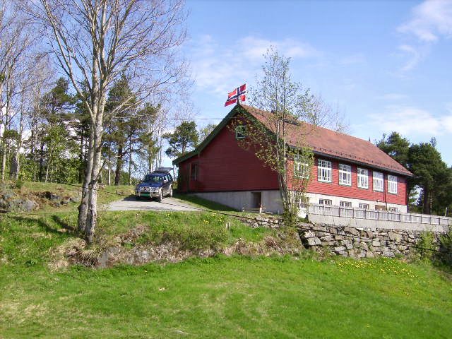
Fjellvarden Village Hall May 17. 2006
Build in 1916 after drawing of
Magnus Dagestad , Voss
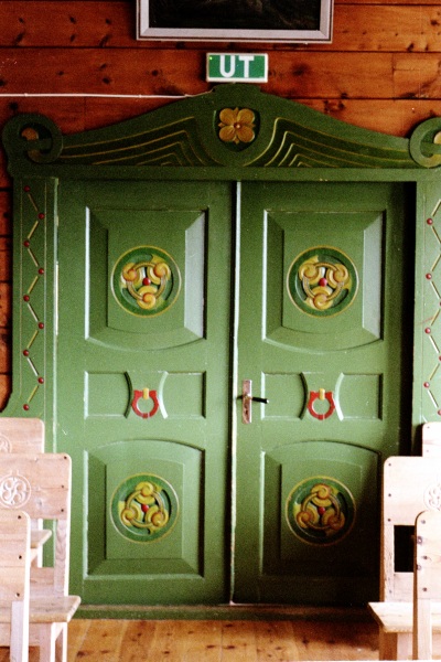
The style you may call "Nordic" , You will see rich carvings and Rose
Paintings inside, on walls and interior.
It is owned by the local youth club, and they are hiring out
to other clubs and associations.
Before the church was build at Roset, it was even used for divine services.
The house has been trough some rebuilding some years ago. For example did we lower the floor in the cellar, build a new kitchen and toilet department. It was a tough job doing the rock blasting inside the cellar without damaging the old stone walls and the rest of the building.
Here at Sølvberg, you can branch off from the road and
visit the alpine pastures and old boat houses at the seaside. To the
pastures it is possible to drive by car, to the sea, you have to walk.
More about those attractions, you will fine
HERE
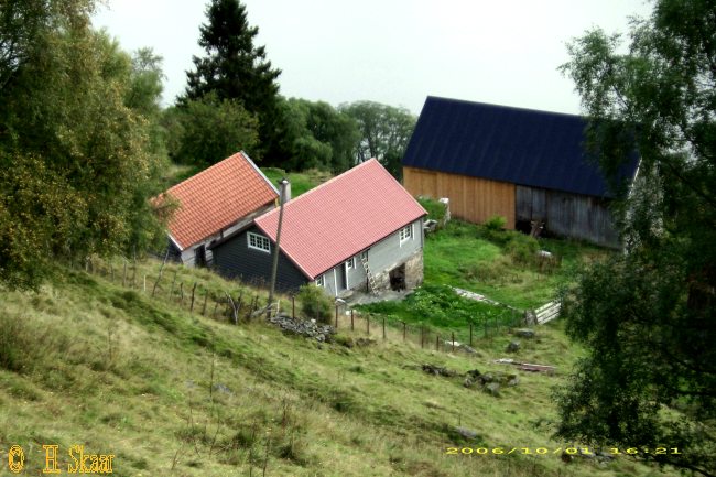
These houses were abandoned in the 60's, when they put up new living house and barn up at the road.
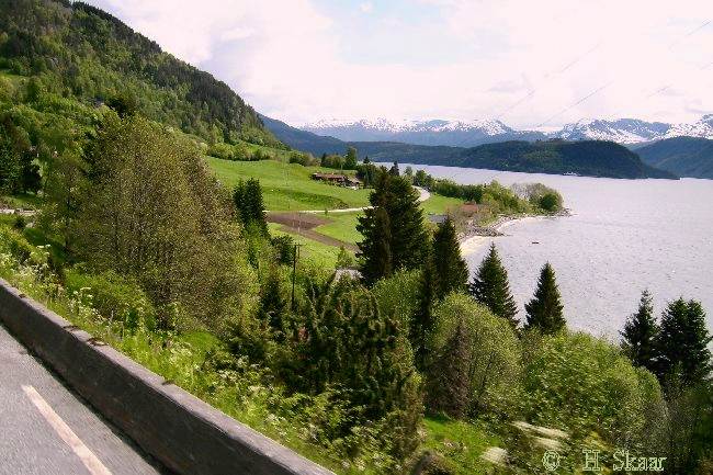
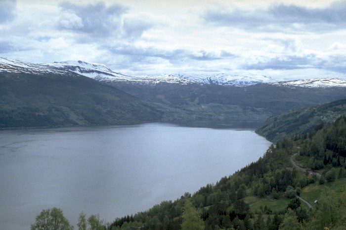
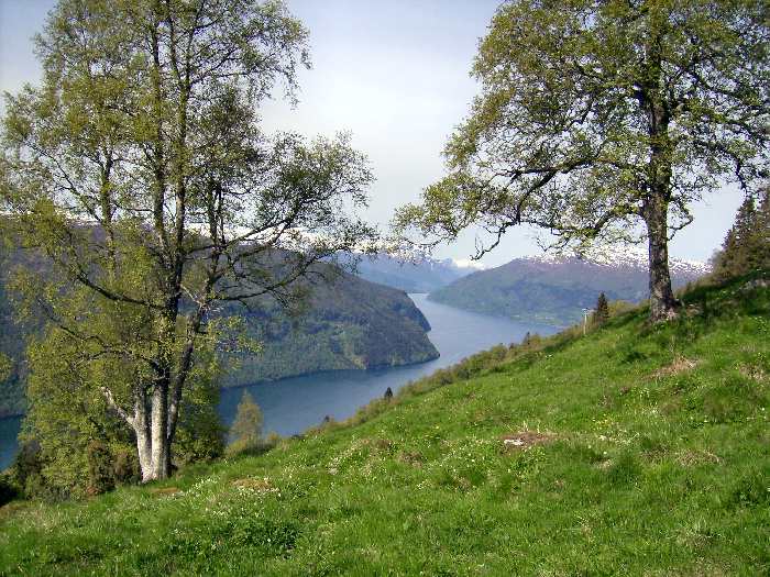
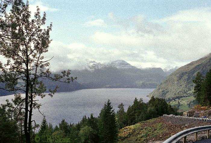
If you make a stop now and then, and step aside of the road, you may find gorgeous views like this one, which I found sunny day in June, 2006, at Gald.
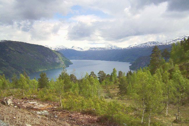
This was the end point of the
road before they made the tunnel in the mid 60's.
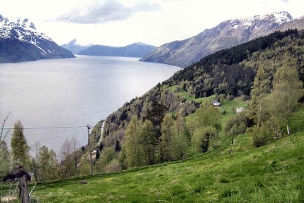
Viewpoint at the road side 500 m above sea level.
Walking path along the temporary road, that was
made and used under the construction
of the new road, to another lovely viewpoint. Kleiva.
Here you will se the
communities Randabygda / Hopland and Hennebygda far beneath in the west.
From this viewpoint you will have easy access to the mountain areas in
the north east.
Kvalen is a headland pointing out in the fjord between Hopland and
Hennebygda, The name
may come from the shape of the headland. Seen from
Randabygda/Hopland, it looks like a whale, resting on the shore, about to
go to the sea. This part of the Panorama road was finished in 2005.
This new part of the road, opened the district for more people than ever
before.
From here, you will have easy access to the mountain areas, and the terrain is easy
to walk in.
At this community you will find a culture path with several attractions. If you have not visited this before, you can do it from HERE
You can see Hennebygda with the farm Henden to the right
The long low headland pointing out from the left is Anda, Here the route E39 make a crossing with a ferry to Lote. Here, at Anda, you also will find the local airport.
On the right side you find Molderheim, Tistam, Djuv, (Djup), Kristisonen and Utvik
Upon the 2nd headland to the left, you find Nos and Kleiva, where we just made a halt. Behind the first headland you find Randabygda and Hopland.
Some years ago, the farmers at Hennebygda was big in growing leek (Allium porrum).. It was told that they in one month could control ( or regulate) the entire commerce with leek in Norway.
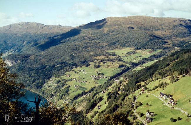
View down to the endpoint of the
Panorama road, from Route E-39
At the head land pointing out from the left, you can make a crossing with a
ferry to Anda.